Industrial landfills: A better way
 The dangers of coal ash have taken center stage in North Carolina in the wake of the Dan River disaster, when a breach in a faulty Duke Energy coal ash pond near Eden unleashed a toxic slurry downstream.
Haywood to spend millions sealing old landfill
 The old Francis Farm Landfill in Waynesville has been closed for nearly 20 years, but its ghost continues to haunt Haywood County.
The county is facing an estimated $5 to $7.5 million in additional environmental cleanup costs for the old landfill, compounding the $1.2 million already shelled out over the past six years.
Study finds success in amphibian pond project
 Take an evening walk through the woods this time of year, and odds are you’ll hear the grumpy quacking of a male wood frog, showing off for the ladies. The sound promises the return of warm days and growing gardens, even as icy temperatures fill the forecast.
For Jessica Duke, this harbinger of a new season coincides with the end of an old. The Western Carolina University graduate student is wrapping up a year of study on behalf of local amphibian species like the wood frog, and what she’s found offers encouragement for animals that are up against some hard times.
Water cents
What falls freely from the sky, rumbles, swooshes, rolls, trickles across the planet; seeps into the earth beneath our feet yet is more valuable than “Texas T,” that foul smelling icky crude that companies spend billions to produce, only to sell for mega-billions?
Tuscola students aim to bring clean water to Uganda
 When Sydney Bridges sets out to do something, she doesn’t give up.
A 10th grader at Tuscola High School in Haywood County, Bridges is currently spearheading a fund-raising campaign to build a clear water well in Kampala, Uganda.
Forests and water could be doomed in 2060
A comprehensive U.S. Forest Service report released last month examines how expanding populations, increased urbanization, and changing land-use patterns could impact natural resources, including water supplies, nationwide during the next 50 years.
WNC lakes join list with mercury warning for fish
 Two more lakes in the region are now under a fish consumption advisory due to mercury contamination.
Unsafe levels of mercury have been detected in fish species in Nantahala Lake in Macon County and Lake Chatuge in Clay County, leading to a consumption advisory on certain species.
Keeping the well full: WCU researchers probe fractured rock aquifers in the mountains
A maze of pores and rock fractures in the Appalachian Mountains make it one of the most complex hydrological systems on the planet. More than half the population here relies on groundwater, but the fundamental question of how many wells the landscape can support remains a mystery.
It’s Dave Kinner’s favorite question for new geology students: how porous is the ground underfoot?
“Feel’s solid doesn’t it?” Kinner asked, stomping his foot up and down, making a flat, muffled thud as it hit the earth.
But in fact, 30 to 40 percent of what’s down there is water, seeping, trickling and percolating through the soil and rock layers — and hopefully, if we’re lucky, making its way to the tens of thousands of drinking wells that pepper the mountainsides of Western North Carolina.
“If we are going to be building more houses in this area, is there enough water for everybody?” asked Kinner, assistant geology professor at Western Carolina University. “At what point would they run out of water? That data is not really out there.”
WCU has emerged as ground zero in the field of groundwater research. An outdoor lab on a mostly wooded tract at the edge of campus sports a cluster of well heads poking up here and there, and in one spot, a tangle of wires sticking out of the soil and a rain gauge mounted on a stick.
While unassuming — particularly since most of the apparatus lies underground — the research is plowing new ground in the field of hydrogeology.
“We have some of the most complex rock types anywhere in the world,” said Brett Laverty, a hydrogeologist with the N.C. Division of Water Quality in Asheville. “We know very little about how groundwater moves in this area.”
And, as a result, very little about the carrying capacity for an increasing number of wells being drilled into the mountainsides.
Several summers over the past decade have brought drought conditions to Western North Carolina. Springs that flowed for generations suddenly dried up. Wells that had worked fine before suffered from low flows. New homeowners had to go deeper than ever before to find water.
Kinner hopes the research at WCU will figure out how much rain is actually making it through the top few feet of soil and into the underground aquifer.
Right now, the rate of groundwater “recharge” is a mystery, Kinner said. How quickly groundwater is replenished, compared to how quickly it is being used, is the fundamental question.
“Will it run out before it can recharge?” Kinner said.
The question attracted the interest of the National Science Foundation, which recently made a $200,000 grant to fund the ongoing project at WCU.
Luckily, recharge in the Appalachian mountains is rather quick, compared to underground aquifers in the Southwest that took thousands of years to accumulate but are being used up in a matter of decades.
But even in this temperate rainforest of the Smokies, groundwater isn’t an unlimited resource, and there are lots of variables at play that Kinner and his geology students are probing.
On steep slopes, rain tends to run off instead of soaking in.
Torrential downpours likewise run off instead of soaking in. And if the topsoil is hard and dry, absorption is even more subpar.
Unfortunately, few rains this past summer were the good slow soakers needed for recharge, according to the technical instruments monitored by Kinner and his students.
Rain gauges record both the amount of rain and how fast it comes down. Meanwhile, moisture sensors at various depths and a smattering of nearby test wells record how deep the rain is penetrating and whether it is actually reaching the groundwater table.
Kinner and his students will soon add their very own rain maker to the mix. A rainfall simulator, a homemade contraption sporting a shower head on a giant tripod hooked to a 200-gallon tank, can be maneuvered into place to test absorption on varying slopes and varying types of “rain.”
Below the surface
Mountain aquifers are defined by fractures, akin to ant tunnels in the rocks, ranging from visible veins to microscopic cracks.
How many — and how big they are — make or break a well.
“It is all about fractures. The more fractures you have in the bedrock intersecting a well, the more fractures you will find conveying that water,” Laverty said.
But the maze of fractures below the ground are completely random.
“A well driller who pulls up in your yard can’t say ‘I think the northeast corner will have more fractures than the southeast corner,’” Laverty said.
In the old days, a bucket lowered by a rope into a hand-dug well seemed to serve the early settlers fine. But that would hardly suffice today, not only because a shallow well like that is susceptible to contamination, but the water table at such shallow depths doesn’t have the volume or reliability modern households demand.
Wells drilled today are like a giant tube-shaped colander. The water seeps through tiny holes to fill the shaft. If the shaft doesn’t cross paths with the fractures and veins that carry water underground, however, it won’t fill up.
When that happens, drillers may turn to hydrofracking, which forces fractures in the rock to split open larger and pull more water into the well. This doesn’t always bode well for flow of other wells nearby, which can possible lose some of their pressure.
While WCU’s groundwater research will go a long way toward answering fundamental questions about how fractured rock aquifers behave in the mountains, it won’t tell us definitively, in each and every case, how many wells are too many. The geology is so site specific, that no single model that could be applied to all of Western North Carolina.
“The aquifers here are very dissected, and the fractures control everything here,” Laverty said.
But, if baseline data existed, carrying capacity could be calculated for a particular mountainsides.
“If you do have a subdivision in a particular watershed, you can start looking at that question,” Laverty said.
In Jackson County, groundwater recharge took a lead role in the debate over development regulations four years ago. The rules imposed a sliding scale for the size of house lots: the steeper the slope, the larger the lots have to be. The reasoning: on steep slopes, more surface area is needed to achieve adequate groundwater recharge, according to county planners at the time.
Unfortunately, climate change doesn’t bode well for groundwater recharge.
“One of the larger questions in terms of recharge is, as our climate changes, it will become drier overall and the rain we do have will be more intense,” Kinner said.
Laverty also believes the changing weather patterns of global climate change is bad news for groundwater recharge in the mountains.
“In the past we had rainfall that is spread out, good soaking rains, but now we are going to be seeing more heavy rains that come like a monsoon,” Laverty said.
Laverty said there’s a lot riding on groundwater aquifers in the mountains — around 50 percent of the population here has wells.
“If we have summers with prolonged droughts, a lot of communities could be in trouble. If your well runs dry where do you go?” Laverty said.
There are steps developers can take to help homeowners down the road capture rain and channel it into the ground rather than allowing it to run off. Things like rain gardens and bioswails collect rainfall and give it a chance to soak it before running down the mountain, Laverty said.
“If you want your little subdivision to survive and have enough water for everybody, that is something you need to take a look at,” Laverty said.
Amassing data, nurturing geologists
Kinner, along with Mark Lord, head of the WCU geology department, recently received a $200,000 grant from the National Science Foundation to support their research.
All together, there are 40 wells of varying depth scattered across three plots on the WCU campus.
The wells were drilled last year courtesy of the state’s Department of Environment and Natural Resources, which is intensely interested in how mountain aquifers work.
The research also aims to understand how shallow groundwater moves laterally through the soil near creeks. Creeks, in essence, are an above ground manifestation of ground water. Creeks are far from static systems, coursing downhill irrespective of the subterranean groundwater around them.
In fact, groundwater not only moves through the soil into creekbed, but in some cases seeps back out of the creeks into the surrounding soil.
This transport of shallow water across soils is being monitored at many of WCU’s test well sites.
There’s another element to the groundwater research that has nothing to do with water, aquifers or hydrology. The geology professors are studying whether undergraduate research approached as a class helps students learn.
WCU has always been big on research. It is actually a requirement of all geology majors.
“The idea is students learn best if they are actually doing things,” Kinner said.
In the past, students undertook an individual research project for a semester, usually in their senior year. This project will engage students from intro to upper level courses, up and down the geology curriculum, allowing the professors to plug different classes in to the long-range research project.
“The grant will allow us to ask the question, ‘How do students at all levels of the geology curriculum benefit from research-based learning?’” Kinner said.
Research fellows will be hired to mentor students engaged in the project. But the applied science will serve a greater good as well.
“We are basically growing more geologists and hydrologists in this area to look at these questions,” Kinner said.
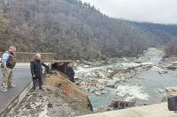
Twenty years and counting: Tracking the health of the Little Tennessee
For two decades, the Little Tennessee Watershed Association in Franklin has been monitoring the health of the river’s water basin from north Georgia to Fontana Lake.
Last week, the group released a State of the Streams report, showcasing both its work and what has been found over the years, particularly the trends from 2002 through 2010. The unveiling took place at a noon luncheon of the Macon County League of Women Voters in Franklin, with about 30 people in attendance.
Overall in the upper Little Tennessee River watershed, two worrisome points stand out, according to the report. Monitoring of threatened and endangered species in the mainstream below Franklin suggests that the decline of native mussels is long term and not just cyclical; and a fish species, the Wounded Darter, has almost completely disappeared from the Cullasaja River.
The good news? The most significant development was the closing in 2006 of the Fruit of the Loom plant in Rabun Gap, Ga., which the group said accounted for more than 95 percent of the total permitted industrial discharges to the entire watershed.
While the closing was hard on those whose livelihoods were dependent on the plant (30 percent of the workforce was from Macon County), benefits were almost immediately visible in the downstream ecosystem. This included the recovery of riverweed, an aquatic plant of the Little Tennessee.
Additionally, in Highlands, macroinvertebrates from Mill Creek are showing slow but continual recovery following the late 1990s shutdown of the Highlands sewer plant.
The condition of the river in the now-protected Needmore area (since 1999) also suggests that positive actions have, at the very least, “counterbalanced” negative trends. The Needmore tract, purchased from Duke Energy to protect it from development through a combination of private and public funding, has been under management by the N.C. Wildlife Resources Commission since 2002.
“Thirteen miles of free-flowing river, no houses or bridges — that’s a pretty unique thing in this part of the world. It’s a really exceptional piece of river,” Bill McLarney, an aquatic biologist who has studied the Little Tennessee River and its tributaries for at least two decades, said of the Needmore stretch of the Little Tennessee River.
Additionally, “we are relatively blessed that we don’t have a lot of point-source pollution,” McLarney said. “Habitat modification and sedimentation is the biggest problem here … that’s what we need to focus the most attention on if we want to see healthier streams.”
Jason Meador, the watershed program coordinator for the Little Tennessee Watershed Association, said the group focuses on a “holistic approach.” The staff and the many volunteers involved don’t just study fish, they also look at and study everything involved in a healthy watershed.
That’s also involved restoration projects, such as taking out culverts and replacing them with bridges, such as the group did on Bradley Creek. The culverts — essentially places where a stream is forced into a giant pipe to pass under a road — often block fish from being able to travel freely up and down tributaries, particularly if the culvert is crumbling, Meador said.
Additionally, the culverts often can’t handle big storm flows, flushing excess sediment.
Where is the Little Tennessee watershed?
The upper Little Tennessee watershed covers 450 square miles of forests, fields, towns and communities in the heart of the Southern Appalachians.
With headwaters in Rabun County, Georgia at the confluence of Billy and Keener creeks, the Little Tennessee River flows north and northwest for 55 miles, unimpeded for its entire length except for Porters Bend Dam, which forms the relatively tiny (250 acre) Lake Emory in the town of Franklin. Before reaching Lake Emory, the river makes its way through a flat, wide valley, dropping less than 50 feet of elevation in more than 10 miles of channel length. Here, the valley is defined by the Nantahala mountains to the west and the Fishhawk mountains and Blue Ridge escarpment to the east.
The stretch of the river between Lake Emory and Fontana Lake is one of the highest quality rivers in the Southern Appalachians, making it unique among the Blue Ridge rivers to have escaped much of the industrial pollution that has degraded so many other rivers in the region, according to the Little Tennessee Watershed Association.
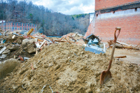
White Oak citizens seek well testing ahead of landfill privatization agreement
While Haywood County’s bid for privatizing the White Oak Landfill is still being considered, the site has now drawn the eye and ire of residents on its borders who fear contamination of their wells by its contents.
The citizens, led by White Oak resident Sylvia Blakeslee, have approached the county to request that 32 of the wells in their community be tested for heavy metals and volatile organic compounds (VOCs).
Blakeslee said she and her neighbors in the White Oak community are concerned because of the recent infractions the landfill faced, including waste being found outside the liner that was, at best guess, up to 10 years old, according to Haywood County Solid Waste Director Stephen King. Blakeslee said they’re also worried by the relatively unstable geologic structure beneath the landfill, pointing to a 1990 hydrogeologic report that warned of “high potential for groundwater contamination.”
“My well is the most critical,” said Blakeslee, who produced a topographic map marking the locations of several wells along the edge of the landfill. “That’s why I’m concerned.”
Her request, however, wasn’t granted by the county, who passed it on to the Asheville regional office of the state Division of Water Quality. They, in turn, realizing that the matter was under the jurisdiction of the state’s solid waste group, tossed it up the chain once more. The request landed with Ervin Lane, a compliance hydrogeologist for the North Carolina Division of Waste Management.
He hasn’t come up with an answer yet, but said he’s looking at testing data from the last 10 years to as recently as April to see if the wells do need to be tested.
“We just look at the data to determine if we think that there is an immediate threat,” said Lane, adding that “the landfill is not really in close proximity of where the wells are located, so we have to just take it step by step.”
King, however, doesn’t see a need for the wells to be tested. He said test wells that actually border or sit within the bounds of the landfill have never turned up any abnormal or increased results for heavy metals or VOCs, and even the ground underneath the off-liner waste wasn’t contaminated, much less the groundwater.
“There was no evidence at all that it even contaminated the ground,” said King. “The clay acted like a natural barrier. We tested a foot underneath the waste and all the way around it and didn’t even find any contamination in the dirt itself.”
But, he said, if Lane returns with evidence that the wells need to be tested, then he will take the necessary steps to ensure the safety of residents’ groundwater.
For her part, Blakeslee said her intention is not to stir trouble. However, when she heard of a possible plan to privatize the landfill, she shifted into gear, poring through papers and thoroughly researching the landfill’s history and possible future.
That’s when concerns about her groundwater and that of her neighbors began to surface. Fearing a rush decision on the site’s possible sale by county commissioners, she passed around a petition and forwarded the paper, with its 40 signatures, to County Manager David Cotton. Her fear, she said, is finding waste in her wells after privatization and being stuck to deal with the consequences on her own.
“I don’t think I have any contamination. I don’t want to have it,” said Blakeslee. “I just want to find out before they sell it [the landfill] off, because then what recourse do I have?”
She concedes that neither she nor any of her neighbors have found or noticed contaminated water, and King and Lane were both unsure of the residents’ motivations for requesting tests now.
But, as Blakeslee said, many of them are concerned about what will happen if site operations are turned over to a private company. Even if their wells get turned down for testing, she said, she will continue to lobby commissioners to research thoroughly any proposal to bring outside trash into White Oak.
“The way to solve it is not to throw it off on somebody else,” said Blakeslee. “Because this has got far, far reaching consequences if the wrong decision is made.”
In a committee meeting on Monday, county commissioner Mark Swanger assured staff and residents that they were in no rush to pawn off the landfill and would wait for all the information before making any recommendations or decisions.
Blakeslee said that’s all she’s asking from the county commissioners: the best, most-informed decision.
I just want them to make the right decision,” she said. “We have a beauty spot and we don’t want it to turn into a boil then a cancer.”