Fire activity resumes
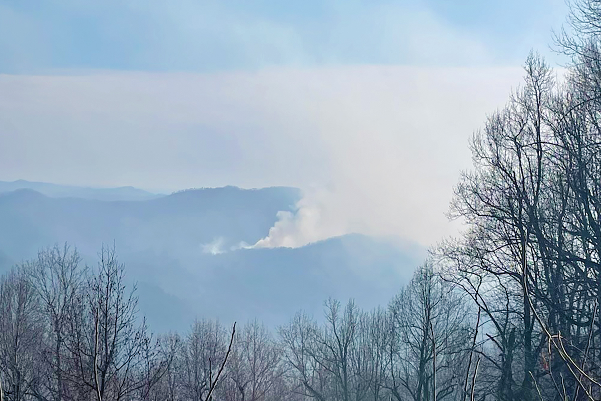 The Locust Cove #2 Fire is one of two currently burning in McDowell County. USFS photo
Despite an uptick in precipitation and humidity levels, the region is still facing the worst drought conditions since 2017, with renewed fire activity over the past week.
In McDowell County, the 180-acre Locust Cove #2 Fire started Nov. 29, while the 124-acre Clear Creek Fire ignited nearby Nov. 30. These fires are 50% and 70% contained, respectively, as of Dec. 5, with no injuries or structures lost.
Meanwhile, firefighters saw renewed activity on the Black Bear Fire in Haywood County Dec. 1. The fire, which is still 90% contained, grew by 200 acres to cover 2,008 acres as it crossed Snowbird Creek. According to an update issued Dec. 4, the 36 firefighters on scene had reinforced the handline between Snowbird Creek and the ridgeline to prevent the fire from spreading further.
The fire, which started Nov. 16 following a tractor-trailer accident on Interstate 40, quickly spread north of the highway. Significant rainfall in the days before Thanksgiving had allowed firefighters to make significant headway. The U.S. Forest Service issued on Nov. 24 what it said would be its last update on the fire “unless significant fire activity occurs,” with the fire 79% contained at 1,888 acres.
The newest drought map from the U.S. Drought Monitor of North Carolina, released Nov. 30 based on data through 8 a.m. Nov. 28, shows the number of counties in extreme drought down to eight compared to 13 the previous week. Similarly, severe drought now affects 34 counties compared to 40 in the Nov. 21 map, moderate drought affects 27 compared to 25 counties previously and 16 counties are abnormally dry compared to 18 previously.
Counties in extreme drought include Jackson, Macon, Swain, Cherokee, Clay and Graham counties. Haywood, Buncombe, Henderson and Transylvania counties are among those in severe drought.
Related Items

Much of Western North Carolina still abnormally dry

Kitchens Branch Fire in Sylva mostly contained

North Carolina sees drought, widespread abnormally dry conditions

Reminder: burning trash is against state law
The rain prior to Thanksgiving brought relief, but impacts were mainly surface-level, including increased topsoil moisture and streamflow levels. Deeper soils, groundwater storage and reservoir levels remain low, and Western North Carolina will finish the fall 5 to 10 inches below normal rainfall. Regular precipitation throughout the winter is needed to keep chipping away at the drought.
Additional rain came over the weekend Dec. 1-2, but little of it fell on the Black Bear Fire, with ridgetops remaining particularly dry. Periods of high winds and heavy fuels like downed trees and stumps in the fire’s interior are also contributing to fire activity. Relief may come midweek, with a cold front possibly bringing more rain.
Travelers should exercise caution when traveling the I-40 corridor approaching the Tennessee line. The Appalachian Trail is closed between I-40 and Brown Gap Road, as is Brown Gap Road (Forest Service Road 148A).