Winter on the ridge: Wintry conditions cause Parkway closures despite warm temps at low elevations
 Though a mixture of rain and ice pelted the windshield as I headed toward the Balsam Gap access of the Blue Ridge Parkway, the forecast was calling for a high of 52 and the car thermometer read 48 degrees.
I was headed up to see what springlike weather down below translated to when sitting at 6,000 feet on the scenic mountain road, because, let’s face it, I was skeptical. The Parkway had been closed for much of the winter, including the previous week, when temperatures in Waynesville climbed up to the sunny 60s.
Pedaling the Parkway: WCU dean completes ninth fundraising ride to Mount Mitchell
 Brian Railsback learned a valuable lesson when he missed a September meeting of the Western Carolina University Honors College Student Board of Directors: skip a meeting, and you just might wind up volunteered to do a century bike ride through the mountains. As Railsback, Honors College dean and English professor, found out later, the meeting concluded with a decision that he should pedal 118 miles to the top of Mount Mitchell to raise scholarship money for the college.
“What happened was I missed that meeting, and they voted unanimously to move forward with it,” Railsback said.
Blue Ridge Parkway closes section for Devil’s Courthouse Tunnel repairs
A small section of the Blue Ridge Parkway, between Milepost 420 (near Black Balsam Road) and Milepost 423 (at Hwy. 215), will be closed from Nov. 3 through May 2015.
Haywood looks to start Friends of the Parkway chapter, clear overlooks
 With park funding falling and visitation increasing, keeping those iconic views open along the 46 miles of Blue Ridge Parkway in Haywood County — without breaking the bank — is a challenge. Fast-growing trees and shrubs grow up around the overlooks irrespective of budgets, so when Parkway Superintendent Mark Woods visited the Haywood Tourism Development Authority’s board meeting last week, it was with a view to talk about how to make those dollars stretch.
A concessionaire’s conundrum: Pisgah Inn owner hoping NPS contract renewal yields 10 more years of local ownership
 By mid-August, there’s already a chill in the air outside Pisgah Inn. Employees and experienced guests walk around in pants and long sleeves, while visitors who didn’t realize August could be this cool sport shorts and tank tops. At 5,000 feet, the panoramic view stays year-round, but autumn comes early.
“This time of year, it’s full every night,” said the inn’s owner/operator Bruce O’Connell.
Breakaway breezes into year five
 More than 400 riders will push off from Lake Junaluska Aug. 16 for the fifth year of the Blue Ridge Breakaway ride, their routes winding through the curvy, rural roads of Haywood County, with the two longer routes even venturing up to the Blue Ridge Parkway.
Resurrecting Graveyard Fields: Blue Ridge Parkway Foundation funds makeover for popular recreation site
 Rhododendrons are opening deep pink blooms along the Blue Ridge Parkway, and new spring foliage blends into a bright blue sky dotted with puffy clouds. At the Graveyard Fields overlook this Friday morning, chirping birds and the occasional passing car are the only sounds. “Idyllic” is the word that comes to mind, but this peaceful scene is far from the norm for this pull-off near mile marker 418.
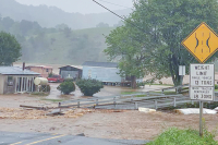
Smokies and Parkway open to windshield tourists only
 The impasse at the federal level will touch all areas of operation at the Great Smoky Mountains National Park and Blue Ridge Parkway, closing picnic areas, campgrounds, bathrooms, visitor centers and historic sites.
Unlocking the mystery of Graveyard Fields: Why there are so few trees and so many people
 While lines of cars zip down the Blue Ridge Parkway and hikers scurry along its zigzagging trails, Graveyard Fields moves at its own pace.
The high elevation meadows of Graveyard Fields are a crowned jewel of the Shining Rock Wilderness. No trees means great views — views without scrambling up a mountain peak or peering out from intermittent windows in the tree canopy.
“Tunnel-phobia” has gotten worse as years go by
 Leading a field trip isn’t complicated. But there may be more to it than you suppose. It helps if you know ahead of time where you’re going to make stops; where to eat lunch; and where the bathrooms are situated.