Panhandling public hearing planned for Sylva
Sylva plans to hold a public hearing on a panhandling ordinance after residents raised concerns about its growing prevalence at the Asheville Highway, NC 107 intersection during an August meeting.
Year of study yields little change for N.C. 107 project
After putting nearly 300 hours and just short of a year toward an effort to develop an alternative vision for the N.C. 107 project in Sylva, the Asheville Design Center presented its findings to the Sylva Board of Commissioners Thursday, July 11.
DOT explains N.C. 107 survey letter mystery
A controversial bypass around Sylva that was supposedly tabled by the highway department last year suddenly and mysteriously seemed to be back on the drawing board last month.
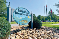
Sylva leaders adopt streetscape plan for Main Street, N.C. 107
The Sylva town board has unanimously approved a streetscape plan for N.C. 107 from the Ingles grocery store to Dillsboro.
The plan indicates where sidewalks and landscape buffers must go, according to the town’s current zoning ordinance, but also shows places were future transit stops, crosswalks and bike paths could go.
Southern Loop on hold
 A decade-long tug-of-war over what to do about Sylva’s congested commercial strip of N.C. 107 took an unexpected turn last week.
Public absent in meetings where road projects decided
The way road projects get selected and prioritized in the state’s six westernmost counties might shift slightly following meetings this week and last by local government officials and transportation experts.
The method of weighing the projects will be tweaked to heighten safety issues. Crash data compiled by the state Highway Patrol will be factored into the equation. Elected officials serving on the Transportation Advisory Committee said, however, they want to see what that actually does to the alignment of projects before endorsing the approach.
How exactly the state Department of Transportation moves forward on road building and road improving has raised pointed questions recently about political and personal gain versus public good and needs. Controversy in the past couple months erupted over two projects in particular: Needmore Road in Swain and Macon counties and N.C. 107 in Jackson County.
The transportation department has proposed paving and widening a 3.3-mile section of Needmore, a gravel one-lane road beside the Little Tennessee River. Needmore cuts through the protected Needmore Game Lands, and opponents say the environmental risks posed are simply too great (see accompanying article on page 9).
In Sylva, the transportation department this month held a public information session on how traffic on N.C. 107 between Sylva and Cullowhee could be reduced. Concepts included widening and building a whole new connector road. At least 200 people turned out for the session, and Smart Roads, a local activist group, promised to monitor and publicize the process going forward.
For all the outcries, no one from the public was present at either of two meetings where a bit of the rubber meets the road when it comes to transportation projects in the far west: Jackson, Macon, Swain, Cherokee, Clay and Graham counties. One meeting was for county and town planners and other government officials, a second was held Monday night for county commissioners and town council members.
Southwestern Development Commission, a regional planning group headquartered in Sylva, organized the get-togethers.
Who does the planning?
In the state’s six westernmost counties, road planning is headed up by the Southwestern Development Commission, headquartered in Sylva, which serves as the lead-planning agency for the rural transportation planning organization (RPO).
Southwestern Commission provides staff and GIS (geographic information system) support. The RPO consists of a technical coordinating committee (government officials) and a transportation advisory committee (elected officials). The government officials, as in real life, exist simply to make staff-level recommendations to the elected officials, who make the policies.
Here are the stated goals of the RPO:
• To provide a forum for public participation in the rural transportation planning process and serve as a local link for residents of the region to communicate with the transportation department.
• To develop, prioritize and promote proposed transportation projects that the RPO believes should be included in the State Transportation Improvement Program.
• To assist the transportation department in publicizing its programs and service and providing additional transportation-related information to local governments and other interested organizations and persons.
• To conduct transportation-related studies and surveys for local governments and other interested entities and organizations.
• To promote transportation as a regional issue requiring regional solutions.
Information session on ‘fixing’ N.C. 107 set for next week
Are you ready to rumble? Because here we go again: The great debate in Jackson County on whether traffic congestion along N.C. 107 in Sylva should be fixed, and if so — how — is back.
Since the summer of 2008, the state Department of Transportation has conducted separate traffic studies, each intended to explore different fixes to the same problem.
The preliminary results of one of those studies is about to go public: potential redesigns of N.C. 107, Sylva’s major traffic corridor, which takes in the primary portion of the county that is experiencing business growth. The targeted stretch extends from U.S. 23 Business in Sylva to Western Carolina University.
On Tuesday, Nov. 9, state DOT officials will hold what’s being dubbed an “informal meeting” in Sylva. They intend to publicly layout what they claim must be done if N.C. 107 is truly going to be fixed.
There are six concepts on the table. Three of those concepts would include building an additional road, the controversial Southern Loop, since renamed the friendlier-sounding (and the transportation department claims, more accurate) “N.C. 107 connector.”
‘Here it is’
The connector, as originally conceived, would blaze a new road through the mountains. Five miles of construction destroying homes, farmland, and taking in streams and forests — a proposal, that on the face of it, is simply too destructive for serious contemplation by many in the county, including those who stand to lose their homes.
Opponents won a small battle when the transportation department broadened its language describing the N.C. 107 connector as a “multi-lane” freeway to include the possibility of a smaller, two-lane road, at least for the purpose of study.
Jackson County Smart Roads Alliance, the group that acted as the brake on the transportation department’s original plans for a multi-lane bypass, has started revving its engines.
The citizen-action group has pretty much lain dormant for the past few years. But this week it held an organizational meeting at City Lights Bookstore in Sylva. Members are promising to once again bring accountability to the process, and to insist on the inclusion of a wide array of community voices before any decisions are made.
“DOT has forgotten we’re paying attention,” said Jason Kimenker between serving up cups of lightly curried butternut squash soup to his lunch customers at the Soul Infusion Tea House & Bistro, smack dab beside the section of N.C. 107 that is being eyed for improvements. “We have simply been waiting to find out what they were going to do. And, here it is.”
But whether Smart Roads can inspire hundreds of Jackson County residents to participate in what’s often a tedious and mystifyingly complex process — as it once did — remains to be proven. The first test comes next week, at the transportation department’s information session.
Meeting is a response to public pressure
Joel Setzer doesn’t actually have horns and a tail, though to hear some critics of the transportation department, that might come as something of a surprise.
In reality, Setzer is a polite, well-spoken Jackson County native who made good and became the very top dog for the 14th Division of the state Department of Transportation. That means he’s division engineer for a 10-county region that includes Jackson County and encompasses the westernmost tip of North Carolina. Today, Setzer lives on the land he was raised on, commuting a few miles each day from Cullowhee via N.C. 107 to his tidy office — replete with pictures of family members and trout — located in the division’s headquarters near Webster.
“This, in essence, is to help answer the question — ‘Can you fix 107?’” he said of the upcoming meeting.
What happened, Setzer said, is the transportation department really listened. No, really, he said, truly they did.
They heard residents (lots of them, hundreds of them at a time at some points), keep asking whether another road (N.C. 107 connector) was necessary. There were questions about traffic counts, about politics versus need, about desires to build roads positioned against a more environmentally friendlier concept of working in the existing footprint.
That led to the information session (not a public hearing) to share what is known at this point. This, Setzer said, is not required of the transportation department — but the project is controversial, and there have been a lot of questions raised.
The central, nagging question? Whether the transportation department is really doing what the community wants in considering a connector, or by making significant improvements to N.C. 107. Or, are these men and women primed to build roads when a few cars back up on the highway, simply shoving their pet projects down the throats of a reluctant citizenry, all the while egged on by a shadowy yet powerful coalition of would-be developers?
Connecting a network of side roads and linking rural routes to relieve pressure on N.C. 107 is the solution the Smart Roads group advocated when it was active. That option was not included in this study.
What’s on the table?
Here’s what’s being dubbed the six “concepts.” They make only limited sense without accompanying illustrations and maps and explanations from engineers. Those will be forthcoming, Setzer promised, at the information meeting:
• Concept 1 — Traditional widening and intersection upgrades with no N.C. 107 connector, approximately 6.2-miles long.
• Concept 2 — Traditional widening and intersection upgrades with the N.C. 107 connector in place, approximately 6.2 miles long.
• Concept 3 — Superstreet concept (think Cope Creek, along U.S. 23/74, where turnout lanes are now) with access management/non-traditional intersections and no N.C. 107 connector in place, approximately 7.5-miles long.
• Concept 4 — Superstreet concept with access management/non-traditional intersections and with the N.C. 107 connector in place, approximately 7.5-miles long.
• Concept 5 — Non-traditional improvements and other access management strategies in selected locations with no N.C. 107 connector.
• Concept 6 — Non-traditional improvements and other access management strategies in selected locations with the N.C. 107 connector in place.
Right off the bat, it is critical to understand that each of these six concepts were drafted using a “D” level of service: “A” would represent the best operating conditions; “F” the worst. “D” is generally considered acceptable in urban areas, the transportation department noted in a document outlining the concepts for N.C. 107.
Setzer acknowledged that even the level of service used as the baseline in drafting these concepts is arguable. And, surely, will be argued.
One additional, very important point: Setzer said he must know what “the county’s vision” is today. Build, don’t build; improve, don’t improve — “people are going to have to say, ‘What is an acceptable level of service?’” Setzer said.
“There needs to be a community discussion on what it would take to fix 107 … and I don’t think you can proceed without knowing where the duly elected officials stand. We need to know what the vision is. Without that, we’ll simply be spinning our wheels.”
What Smart Roads advocates want
If you want to get involved, it pays to know what you are getting involved in. Jackson County Smart Roads Alliance promotes these alternatives:
• Expand and connect existing roads to accommodate present and future traffic.
• Implement access management concepts and other “traffic calming” solutions for N.C. 107.
• Encourage walkable communities, making it easy for people to get where they need to go without driving.
• Build and expand bike lanes and support the Jackson County Greenway plan.
• Develop public transportation and utilize pre-existing railroad lines.
• Advocate for DOT to use earmarked funds for transportation alternatives.
• Preserve the Tuckasegee River corridor for public use.
Interested? Then learn more at http://wnc.us/smartroads.
Understanding N.C. 107
N.C. 107 is the only major north-south transportation route in Jackson County, and serves as a “collector” for numerous secondary roads, many of which are dead-end roads that have no “connectivity.” It joins Sylva in the north with Cashiers in the south, traveling through Webster, Cullowhee and Tuckasegee in between.
There is dense commercial development along U.S. 23 Business and N.C. 107 between U.S. 23-74 and N.C. 116. About 95 driveways intersect this 3.3-mile roadway segment. Smoky Mountain High School, Fairview Elementary School, Southwestern Community College and Western Carolina University are located along, or near, N.C. 107.
N.C. 107 is a five-lane, curb-and-gutter roadway with narrow 10-foot wide travel lanes from U.S. 23 Business to approximately 1,000 feet south of Fairview Road. From there, N.C. 107 transitions to a four-lane, median-divided facility. Under 2008 conditions, the five-lane section is at, or over, its traffic-carrying capacity during peak traveling hours. By 2035, the entire five-lane section will be operating over capacity.
SOURCE: N.C. Department of Transportation
Get Involved
WHAT: Informational meeting on fixing traffic problems on N.C. 107 in Sylva.
WHERE: Balsam Center (Myers Auditorium lobby), Jackson County campus of Southwestern Community College, 447 College Road in Sylva.
WHEN: Tuesday, Nov. 9, from 5-7 p.m.
WHY: To share six “concepts” that could fix perceived traffic-flow issues.
WHO: Sponsored by the state Department of Transportation.
New bypass alone can’t fix N.C. 107 traffic
A fix for impending traffic congestion on N.C. 107 in Sylva doesn’t lie solely with a new bypass but will require a redesign of the commercial artery itself, according to the latest traffic projections by the Department of Transportation.
Two sides have emerged in the long-standing debate over whether to build a new highway around Sylva. One camp wants to build a bypass allowing commuters to skirt the commercial mire of N.C. 107. The other wants to redesign N.C. 107 so traffic flows better.
The answer could be both, according to recent DOT traffic projections. The Jackson County Transportation Task Force held a public meeting last week to gather input on both ideas, although participation was very low.
A new bypass would not divert enough cars from the commercial hotbed on N.C. 107 to solve future traffic woes, according to the traffic projections. Back-ups on the stretch largely stem from people coming and going from places along the congested stretch itself, according to Pam Cook, a DOT transportation planner working on a master transportation plan for Jackson County.
Opponents of a new bypass, known as the Southern Loop, have long insisted that it wouldn’t solve congestion. Joel Setzer, head of the DOT for the 10 western counties, said he, too, always knew that a bypass wouldn’t solve all the problems. It’s one reason Setzer called for a separate congestion management study now underway by DOT experts in Raleigh.
Whether the result will be a full-fledged redesign of N.C. 107 or simply tinkering with the timing of stoplights won’t be known for at least a year, likely much longer. The congestion management study is still in its early stages — so early in fact there are no numbers on how much a redesign will help.
Theoretically, a host of congestion management techniques could be implemented, each one ratcheting up the traffic flow and reducing back-ups. Although the DOT engineers haven’t run the specific traffic models to see how much each technique would help, they’ve looked at it enough to say that whatever it is, it won’t be enough.
“Will it be enough to handle all the traffic to make it function well?” asked Cook. “Probably not. That is something we have to determine.”
Why not wait before making a decision in that case, asked Susan Leveille, a member of the Jackson County Smart Roads Alliance.
“I am still a bit confused why we can’t look at congestion management on 107 before we spend hundreds of millions developing a bypass,” said Leveille. “You need to look at the small things you can do. You don’t bulldoze down your house because you need another bathroom.”
Decision pending
The Jackson County Transportation Task Force will be asked to endorse a countywide transportation master plan in the coming months. It not only will address N.C. 107, but span the entire county — from congestion in Cashiers to Main Street in Sylva to the campus of WCU.
The task force is being pushed to put its stamp of approval on a long-range plan — which at the moment calls for the construction of the bypass — before the traffic models for 107 fixes are finished.
Jeanette Evans, a member of Smart Roads and opponent of the by-pass, questioned the wisdom of endorsing a bypass until the task force has a better handle on how much fixes along N.C. 107 will help.
“I would like to be able to play with 107 in some respects to see how it works if we do this or that,” Evans said at a public meeting last week.
Ryan Sherby, a transportation coordinator who serves as a liaison between mountain communities and the DOT, questioned whether that was the task force’s job.
“The task force is a vision body, not an engineer body,” Sherby said.
“If you don’t know what the options are or the consequences of this or that action, how can you vision?” countered Leveille. “It seems to me like we are being asked to make a decision without all the information.”
Cook reiterated that congestion management, while needed, would fall short.
“My opinion at this point is that I don’t think there will be enough with congestion management,” Cook said.
Leveille and Evans said they did not understand why they are being rushed into approving a plan by July. The task force spent 18 months corralling and sifting through population and growth data. It only began the nitty-gritty work of analyzing the different road options two months ago. July is too soon to sign off on a master plan, they said, especially since it addresses everything from widening Main Street on the outskirts of Sylva to widening U.S. 64 in the middle of Cashiers.
“I don’t see how we can come up with a comprehensive plan in a matter of three or four months,” Leveille said.
Initially, the July deadline would allow the DOT to incorporate the task force recommendations into its annual planning process, Sherby said. It could be pushed back a couple months, however, Sherby said.
All the options are predicated on traffic models for 2035, when congestion on some roads will surpass what the DOT considers acceptable. But that model has been called into question.
“Are we planning for 2035 as we have lived in the past?” questioned Myrtle Schrader, who attended the meeting last week. “I don’t hear anything about the future of transportation. We need to look at what our lifestyle can and should be here in the mountains.”
Dr. Cecil Groves, president of Southwestern Community College, said that it is fair and accurate to assume there will be more cars on the road by 2035.
“What we know is if we don’t do anything it only gets significantly worse and more difficult to correct. The population here is going to grow. So we have to make an educated guess the best we can,” Groves said.
Groves advocated for more thought-out land-use planning that would influence commercial growth, rather than figure out how to accommodate it once it has cropped up.
Another question involved the DOT’s definition of congestion. Is the congestion a brief spike during commuter hours, or is it sustained and chronic? Setzer said the congestion was more than a momentary spike, but wasn’t all-day congestion either.
Compromise afoot?
News that the DOT is considering a redesign of N.C. 107 coupled with a bypass — rather than either-or — could signal the beginning of a compromise.
The bypass, formerly known as the Southern Loop, was initially billed as a major freeway through southern Jackson County, looping from U.S. 23-74 north of Sylva to U.S. 441 south of Dillsboro. Somewhere in between it would cross N.C. 107 with a major interchange.
In response to public opposition, the DOT dropped half of the Southern Loop — the part extending to U.S. 441 south of Dillsboro.
The DOT is still seriously contemplating the other half, but the language describing the road has been toned down. Instead of the once-touted four-lane freeway, the DOT shifted gears in the past year to consider a two-lane road instead.
That two-lane road would claim enough right of way to accommodate four lanes one day, said Joel Setzer, head of the DOT for the 10 western counties. It would still be designed for a speed of 55 miles per hour. It would still operate like a freeway in the sense of limited access from driveways or intersecting roads. And where it joined N.C. 107, it would likely have an interchange rather than an intersection with a stoplight, Setzer said. But the two-lane concept is scaled down nonetheless.
Spot land-use plan to mark first forray into zoning
Jackson County leaders have finished the first draft of a planning ordinance they hope will transform the U.S. 441 corridor in Whittier from a mish mash of billboards and unregulated growth into a model of tidy landscaping and mountain-themed architecture.
The U.S. 441 Development Ordinance made its public debut at an April 30 presentation at the Qualla Community Center. It now must go to the planning board for a review, then before county commissioners who will the decide whether to pass it into law. If it passes, Jackson will be the first county west of Buncombe to make a foray into land-use planning or zoning in a mostly rural unincorporated area.
The document, created by a county-appointed steering committee, is the culmination of a year-long process. At nearly 100 pages, it calls for mandatory landscaping and architectural standards, limits the size of signs and requires dumpsters to be screened.
Commercial development along the corridor is sparse now. But water and sewer are being installed along the highway, priming the pump for more intensive development to follow. The ordinance sets out a vision to guide anticipated growth from the outset along the stretch, which serves as an entrance to the Great Smoky Mountains National Park and Cherokee.
“I know what is pretty and what is ugly is a matter of perspective, but on the other hand, there is signage and a type of building construction that I don’t believe is good for the community or the southern entrance of the (Park),” said Bill Gibson, a steering committee member, at the first public presentation of the ordinance.
Jackson County Planning Director Linda Cable said the appearance of the corridor is critical, since it’s a major gateway to the nation’s most-visited national park.
“This being a tremendous tourist attraction, it’s important that the corridor remains pleasing to visitors,” Cable said.
Gibson expressed high hopes that the ordinance, “will make the corridor both a safer travel route and a landscape over time that will become more pleasing not only to folks that live here, but travel here.”
Model process
The process of creating a planning document for the corridor began when citizens approached commissioners with concern over growth poised to follow the extension of water and sewer lines. Commissioners took heed and hired consulting firm Kimley-Horn and Associates in November 2007 to oversee the process. What followed was a series of stakeholder interviews, workshops, and a four-day series of interactive meetings with a team of planners, engineers and architects where public input was sought to create a vision for the area.
The public had plenty to say.
“There was overwhelming participation in this event,” said Matt Noonkester, a Kimley-Horn consultant for the project. “I think that’s what made the vision so important and so valid.”
Billboards were a big issue for people during the planning process, Nooncaster said. Participants were asked to guess how many billboards lined the corridor. Estimates ranged into the 300s — far below the actual number of 68, but a testament to the perception of clutter they created.
Community members wanted design guidelines to address building appearance and advocated for the creation of a development district to guide future growth. They overwhelmingly supported the development of a community brand, which would include a color palette, appropriate building materials and signs of a certain shape and size.
“There was strong support to look at regulating building architecture,” Noonkester said.
They liked the idea of a pedestrian-friendly, four-lane road with a landscaped center median.
Public input was compiled into the Small Area Plan, adopted by county commissioners in April of 2008. The document would serve as the foundation for a more comprehensive ordinance.
The bottom-up approach to planning was lauded by many who watched the process unfold. The Small Area Plan actually received an award from the American Planning Association.
“It was a really good model, not only for the ordinance that came out of it, but also the process,” said Ben Brown, communications coordinator for the Mountain Landscapes Initiative, the region’s largest-ever planning effort. “They chose to use a charette to talk directly to the community and help shape the principals and goals of the ordinance, which makes a lot more sense. That was the first really good example in the region of how to go about planning.”
Finding balance
Public opinion was kept at the forefront as the steering committee worked to draft the development ordinance.
Committee members, many longtime residents of the area themselves, had to strike a delicate balance between economic development and retaining Whittier’s beauty and character.
Debby Cowan, a steering committee member, spoke of the her experience trying to reconcile the two. Cowan said she wanted to preserve the area’s natural beauty, “but also recognized that Food Lion was one of the greatest things that happened in our community.”
Gibson also talked of trying to strike a balance.
“I have a great respect for individual property rights,” he said, but at the same time, “some of the changes we’re seeing right now are not in the community’s best interest.”
Though a strong private property rights sentiment might make some mountain folk wary of growth rules and regulations, it’s also important to develop in a wise manner, said Eastern Band of Cherokee Indians Vice Chief Larry Blythe. The tribe was heavily involved in the process.
“It’s hard to put restrictions on people’s land, but when you’re talking about smart growth and the long term, we the tribe support this effort,” Blythe said.
During the process, committee members worked to shed their personal beliefs for the sake of what was best for the community as a whole.
“We feel like this is something that was prepared from the viewpoint of all the different people and all the different backgrounds of people in the community,” said Cowan. “While we don’t have it perfect probably, we do think the framework is something we worked very hard to make support everybody in the community.”
The committee’s efforts to include all viewpoints didn’t go unnoticed, said Michael Egan, the county’s consulting attorney on land development matters.
“I was very impressed with the dedication the committee had, always trying to think of the rest of the folks. There’s wasn’t a meeting that went by that somebody would say, let’s step back and take a look at that; let’s consider what affect that’s going to have on our neighbors and the folks who live here,” Egan said.
Billboards: Tourist draw or clutter?
The draft development ordinance for U.S. 441 encourages development that helps maintain the area’s natural beauty and character — a style dubbed “mountain authentic.” According to the ordinance, the ubiquitous large, colorful billboards that line the corridor aren’t in keeping with the area’s character, and are prohibited. The ones already in existence will be grandfathered in, however. Under the ordinance, signs are limited to 32 square feet. Preferred sign materials include brick, stone, and exposed timber.
Miami Lively, a representative of Santa’s Land Advertising, which owns a number of billboards, raised protest to the strict requirements at the public presentation of the document.
“You cannot put most people’s logos and directions on a (32-square-foot) sign,” Lively said. “The bigger the sign, the easier to read. We agree we don’t need a whole bunch of clutter, but the business owners are paying taxes for their businesses. If they don’t make money, the tax money isn’t going to come in.”
Lively added that “billboards bring tourism to the area.”
Ron Servoss, a community resident, disagreed that billboards enhance an area.
“I drove the corridor into Washington, D.C., last week, where there are no billboards allowed, and it was just wonderful to see the countryside,” Servoss said.
Noonkester pointed to the commercial corridor outside Sylva off N.C. 107, where billboards have been allowed to spring up without regulation. The road, and the unchecked growth along it, is often used as an example of what to avoid becoming.
“How many people like driving N.C. 107?” Noonkester asked, citing its sprawling strip mall and fast-food appearance. “The people of Cherokee would benefit more if this place keeps an identity they can associate with.”
The steering committee hopes it has nailed down that identity in the development ordinance.
“As we grow, I hope that future generations can look back on this group and say, they did a really good thing for this community,” said County Commissioner William Shelton.
What’s in store?
Here’s a sample of the aesthetic standards called for in the U.S. 441 Development Ordinance. For the complete ordinance, go to www.smokymountainnews.com.
• Accepted building materials include stone, exposed timber, fiber cement siding, wood siding, and shingle siding. No aluminum buildings.
• Dark and earth-tone building colors are strongly encouraged. Intense, bright, black or fluorescent colors shall only be used as accents.
• Dumpsters must be screened and blend with the building.
• Trees must be planted around parking lots and shrubs must be planted around building foundations. Landscape plans must be prepared by a landscape architect or designer. Trees must be planted in parking lots that are more than 8,000 square feet.
• Billboards are prohibited. Other signs cannot exceed 32 square feet.
Task force aims to fix future traffic snarls
A Jackson County task force has entered the nitty-gritty stage in its quest to fix traffic congestion on N.C. 107 in Sylva.
The group has begun compiling a long list of possible solutions to the congestion. Once complete, it will turn the list over to the Department of Transportation to assess whether and how much each idea could help.
The solutions fall into one of two categories. One is to alter the design of N.C. 107 to handle more traffic. The other is to divert cars off N.C. 107.
Jackson County is split into two basic camps of how to solve traffic congestion on N.C. 107. One advocates building the Southern Loop, a cross-county highway that would bypass the main drag of N.C. 107 and tie in with U.S. 23-74 north of Sylva. Initially conceived as a large-scale freeway, road planners now say it could be a boulevard or even simple two-lane road.
The second camp wants to redesign the existing N.C. 107 and use smaller side roads to handle some of 107’s traffic.
Just how much congestion the task force is tasked with solving has been the subject of debate over the last several months (see related article.) The latest prediction claims there will be around 1,000 to 2,000 cars too many using N.C. 107 during the peak commuter hours by the year 2035.
The projection was formulated using DOT models and growth formulas, and massaged with help of the task force.
Some members of the task force remain concerned over the growth assumptions plugged into the model. The pace of growth witnessed over the past 25 years may not hold true for the next 25.
“Then this overage you are trying to address may not be accurate,” said task force member Susan Leveille.
Those in favor of the Southern Loop want to make the future congestion look worse to justify the road, Leveille said. Likewise, those who don’t want to build the Southern Loop want to downplay future congestion.
Diverting traffic
The name of the game is figuring out how to deal with 1,000 to 2,000 more cars than the road can handle. That’s where the brainstorming process and solutions pitched by the task force come in.
Those opposed to the Southern Loop hope to shows the overage can be handled without building a new highway. Those in favor of the Southern Loop claim the only way of dealing with that many cars would be building the new bypass.
The Southern Loop isn’t the only way to divert cars off 107, however. There are other ways to lighten the load. One is a system of smaller network roads: a system of shortcuts, more or less.
Another option for lightening the load doesn’t involve the roads at all. For example, if more students and faculty lived in Cullowhee, they wouldn’t be driving up and down N.C. 107 to get to campus. The county could enact land-use strategies to encourage more residential development around Western, according to Pam Cook, a DOT transportation planner working with the task force.
“That would be something that only elected officials can change, but that can certainly be evaluated,” she said.
Another option to get cars off the road is a commuter bus between Sylva and Western Carolina University in hopes of decreasing cars on the road.
When it comes to altering the design of N.C. 107 to handle the traffic overage, solutions being pitched include rerouting intersections, adding lanes and congestion management strategies.
Some solutions, when packaged together, can actually result in exponential improvements. For example, an intersection redesign could increase carrying capacity by 2,000 cars and an extra lane by another 2,000, but when done together could carry an extra 5,000.
“We’ll try to strategically group those,” said Ryan Sherby, community transportation coordinator for 10 western counties.
A whole category of solutions falls under the umbrella of congestion management. Congestion management can streamline traffic and increase what the DOT calls the “carrying capacity” of the road. But the congestion strategies might not be included in the numbers game aimed at coping with the projected overage, Cook said.
But the techniques are being considered. A team that specializes in congestion management visited Jackson County and performed a cursory analysis of N.C. 107 last year at the behest of the local DOT. The report from their visit is not yet out, but could be promising, Cook said.
“They may not solve all the deficiencies but would certainly make things operate more smoothly,” Cook said.
Cook said the team would like to make a second visit to examine a few options more closely.
The public can join in the brainstorming as well. Anyone with a solution they think the task force should put on the list to run by DOT can contact Sherby at This email address is being protected from spambots. You need JavaScript enabled to view it. or 828.586.1962, ext. 214.
Stop-and-start process now rolling
Jackson County task force members are excited with the new stage of their work. The task force was formed six years, but faltered for much of its existence due to a revolving door of DOT staffers, including long windows with no staff person assigned to the task force at all.
“I feel like we are just getting started with what I thought would be happening five years ago,” said Susan Leveille, a task force member and representative of the Smart Roads coalition. “We have been sitting listening for such a long time, and for a long time we had a void of nothing. I am very glad that we finally have an opportunity for input that seems to be genuinely part of the process.”
The current DOT staffer assigned to the task force marks the fourth since its creation, and each one essentially started again from scratch upon taking over. But the latest at the helm, Pam Cook, appears to be in for the long haul and the task force is finally showing concrete progress.
Cook said every solution pitched in the brainstorming stage will get evaluated.
“Every thought needs to be considered. Some can just be considered by discussion, some thoughts will be evaluated through a model, others we’ll have to go out into the field and see if it is feasibly possible to connect this road and that,” said Cook, who specializes in community transportation planning. “There is not a bad idea.”