Land use plan ‘truthometer’: What really happened to all those new businesses that were coming to Waynesville?
Did Waynesville run off a Cracker Barrel? What about Chick-fil-A? Challengers running in next week’s town election say Waynesville’s appearance standards for new commercial business are deterring development.
A political action committee calling itself the Waynesville-Haywood Concerned Citizens are publicizing the claims, dedicating a web site to the cause and taking out newspaper ads.
The Smoky Mountain News attempted to chase down the facts behind the group’s claims and determine if Waynesville residents are being unjustly deprived of waffle fries and home-style biscuits.
Cracker Barrel
The rumor: Cracker Barrel was going to come to Hazelwood near exit 100 but backed out because it couldn’t erect a super tall sign on a pole visible from the highway.
Critics say: “There was a big squabble over the height of the sign between the Cracker Barrel executives and the town of Waynesville,” according to Kaye Talman, organizer behind Waynesville-Haywood Concerned Citizens.
Talman said she got her information from the property owner trying to sell to Cracker Barrel, Terry Ramey. Ramey said he never talked to Cracker Barrel himself.
“I am just going by what the Realtor told me, which is they couldn’t buy it because they couldn’t put their sign up. Somehow or other they talked to the town because that’s the reason. They won’t go nowhere where you can’t see their sign,” Ramey said.
Realtor weighs in: The Realtor for the property, Dan Womack, tried to market the site to Cracker Barrel, but Cracker Barrel said the town’s population wasn’t big enough to come here.
“They said the demographics at this point in time weren’t here, population and what all. Of course, Cracker Barrel likes their sign. They never came out and said that was an issue, but I’m sure that would have come up. But, we didn’t get that far. The conversation was that the demographics did not fit their business plan,” Womack said.
Town says: Cracker Barrel has never contacted the town.
“I have not received any specific proposal or nonspecific proposal from anyone affiliated with Cracker Barrel,” said Town Planner Paul Benson.
While the town’s sign restrictions would not allow the giant sign typically erected by Cracker Barrel, if it actually wanted to come to Waynesville, it would have approached the town to ask for an exemption.
“Waynesville would not be a company the size of Cracker Barrel’s first rodeo. They would call us up and say, ‘Hey look, we want to come to town and is there anything we can do about the sign height,’” said Byron Hickox, town zoning administrator.
Annie’s Bakery
The rumor: Annie’s Bakery, an organic and natural bakery based in Sylva, was looking for somewhere to relocate its burgeoning wholesale product line. A site in Waynesville was in the running, but development regulations killed the deal and Annie’s went to Asheville instead.
Critics say: Kaye Talman said she heard about Annie’s from the property owner who was trying to sell his vacant building to the company. But, it was going to cost $175,000 to bring the building into compliance with the town’s development standards, and it was cost-prohibitive.
Annie’s says: Joe Ritota, the owner of Annie’s Bakery, said he chose Asheville to locate his growing wholesale line because it is closer to the distributors that carry his products, like Ingles. Also, all the property he looked at in Waynesville was too expensive.
“Regardless of the land use plan, the building owners we had spoken to were asking way too much money for their cost per square foot. It was so much more competitive in Asheville,” Ritota said.
Plus, the condition of the buildings was poor and would have required a substantial investment to make the space useable.
Town says: “We just had very preliminary conversations with them. The way we left it with them was we would work with them to make it happen,” Town Planner Paul Benson said.
“It wasn’t like they said, ‘We have to do it like this’ and we said, ‘No, you can’t do it that way,’ so they left. We discussed alternatives with how they might comply with the ordinance.”
Chick-fil-A
The rumor: Chick-fil-A wanted to come to an unspecified location in Waynesville, but some aspect of the town’s ordinance was prohibitive.
Critics say: “Chick-fil-A has attempted several times. I wouldn’t speculate on the circumstances, but I do know the town of Waynesville blocked it,” said Kaye Talman.
Town says: Chick-fil-A has never approached the town. It’s unlikely they wrote off Waynesville based on the ordinance without first broaching the town.
“I would say in general if a business was serious about being here and wanted to make a positive contribution to the community they would take the trouble to talk to the town about their project. We always work with businesses to make their development happen,” Town Planner Paul Benson said.
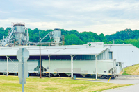
Walgreens drug store
The rumor: Walgreens wanted to build on South Main near the new Super Walmart, but the town’s required parking lot configuration was a deal killer.
Critics say: The town required new businesses to put their parking lots to the side or rear of the building instead of in front. Walgreens wanted its parking lot in front and wouldn’t come because of that.
Town says: This is true. Walgreens tried to get an exemption for its parking lot, but the town denied the request.
“They just felt like they had to have that,” Benson said. But, that wasn’t all.
“It is hard to say if that is the biggest issue because they also had an issue with some of the design standards,” Benson said.
This is the only business Benson knows of in eight years that didn’t come here because of the town’s ordinance.
Page count of the land-use plan
The rumor: Waynesville’s land-use plan was 1,600 pages long. After a year-long review, it was modified and is now 800 pages.
Critics say: “They went from 1,600 pages, which is over three reams of paper, to 800,” said Kaye Talman.
Town says: “The former ordinance was 576 pages. The revised one is 258. I have no idea where the 1,600 number came from,” said Paul Benson, town planner.
Too fancy or just right?
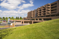
Waynesville has spent $7 million over the past four years building a new fire station, police station and town offices — projects that have come under fire by some challengers for the town board.
Opponents point to the architecture — the brick towers on the fire house, the wood timber frames over the police department entrance — and question how much they added to the price tag.
“I think it is a little extravagant,” said Hugh Phillips, who is running for mayor.
“They may be just a bit more than we really needed,” said candidate Sam Edwards, calling the buildings too fancy. “It certainly helped prettify things, but I don’t know if that was what we should be doing right now.”
But the incumbents say the attractive building design added little to the cost and was worth it.
“I am proud of those things, and if they want to rag on me for that, guilty as charged,” said Waynesville Mayor Gavin Brown.
Mary Ann Enloe, a challenger in the race, lauded the buildings and doesn’t consider them extravagant.
“I think the designs are beautiful,” Enloe said. “Why didn’t we make the justice center look like that?”
Alderman Gary Caldwell said the town actually scaled back some elements of the building design.
“It could have been far more fancy than what it is now,” Caldwell said.
The new police department on Main Street also houses the town planning office where developers and entrepreneurs come for their building permits and business licenses. It was important for it to look nice, Brown said.
“You are trying to create atmosphere when they come in to town they are impressed, that they are in a progressive arena, a place where people are doing things,” Brown said.
Criticism of the town building projects has originated from a political action committee called the Waynesville-Haywood Concerned Citizens. A web site by the group cites the “ostentatious” police department and “extravagant” fire station.
The web site questions a few others town spending priorities as well, but one of the chief examples is inaccurate. It blasts the town for spending money on fancy downtown art. However, no town tax dollars went for the public art pieces. They were funded entirely with private donations.
South Main makeover: Let the brainstorming begin
When new bikers show up for his weekly ride in Waynesville, Cecil Yount pulls out all the stops: a riveting trip through town to Super Wal-Mart and back.
While lacking in scenery, Yount is sending a message to the cyclists — look how easy it is to bike to the store.
Yount’s regular jaunts down South Main Street give him a rare insight on traffic, one he hopes to impart as the town crafts a vision for a South Main makeover. Namely, Yount doesn’t think the street needs to be much wider than it already is.
“I have yet to see the need for four lanes of traffic,” Yount said. “There have been fairly minimal times I have spent sitting waiting on a light. I just don’t see it.”
Yount, the chair of Bicycle Haywood NC, plans to be front and center at a road design workshop next Tuesday when the town will collect input on South Main from the community.
Perhaps it’s no surprise a cyclist wants a quainter road, one with slower traffic, wide sidewalks, shady trees, and not as many lanes for cars.
But even development interests aren’t necessarily clamoring for more lanes, even though South Main sports the ultimate magnet for commercial sprawl. Property owners raced to put their lots on the market when Super Wal-Mart came to town three years ago. They are still waiting for the boon, although real estate experts claim it will come to fruition sooner or later and has merely been sidelined by the recession.
Brian Noland, a Realtor with RE/MAX Mountain Realty, represents half a dozen sellers marketing their property for commercial development along South Main. His office sits on South Main, making Noland another authority when it comes to sizing up traffic needs on the road.
His verdict: three lanes would do nicely, perhaps even with roundabouts instead of the standard stoplights.
When asked whether South Main seems congested, Noland paused, then answered, “I don’t think it is.”
To be sure, he wheeled around and asked his coworkers in the office. Not congested, they concurred.
Noland believes South Main will eventually be home to a row of fast-food restaurants, drug stores and retail. But he wants to keep “our hometown image.”
But Noland is also trying to protect the lots he’s marketing. More lanes will eat into the property fronting South Main and make the lots harder to develop, he said.
That’s also why he’s a fan of roundabouts. Traffic lights equal turn lanes for stacks of cars to pile up while waiting for their signal. Those turn lanes add to the road’s width and encroach on precious commercial lots.
Roundabouts, on the other hand, keep traffic moving and don’t need turn lanes for cars to queue up in, Noland said.
Waynesville has two roundabouts, which were initially met with skepticism but in practice have been well received.
“I didn’t like them immediately when I moved here because they were new, but they really move the traffic through,” Noland said.
Road designers with the N.C. Department of Transportation are conducting their own feasibility study of South Main concurrently with the town, and have proposed a large four-lane road with a center median.
“I think everyone has been assuming that is what will happen there, that it will be four lanes,” said Paul Benson, Waynesville’s town planner.
But Benson said the DOT plan is too big and too wide for the town’s tastes. Town leaders want a more tailored vision, designed in keeping with smart growth principles and walkable community ideals.
“DOT strictly stuck with just a road and trying to get people through the area as fast as efficiently as they could,” said Mark Teague, a private traffic engineer consultant in Waynesville.
That’s largely what led the town to pursue a feasibility study of its own. The independent feasibility study will cost $55,000, with 80 percent of the cost paid for with a federal planning grant.
Yount is pleased the town is rejecting the DOT’s feasibility study and doing one of its own.
“I think the DOT study is going to do nothing more than create another Russ Avenue and that’s the last thing this town needs,” Yount said. “The philosophy needs to change from ‘Let’s move cars as quickly as we can’ to ‘Let’s have smart transportation alternatives and livable streets.’ We may need to de-emphasize moving a single car from one point to another.”
To most, anything will be better than the status quo. South Main doesn’t exactly look the part of a booming commercial district. It is pockmarked by boarded-up windows, weed-engulfed parking lots, cracked pavement — even concertina wire around one windowless cinder block building.
“That is not what Waynesville is all about,” said Ron Reid, the owner of Andon-Reid Bed and Breakfast. “That corridor just needs help. It needs to be cleaned up.”
Reid winces to think about tourists coming to Waynesville for the first time via South Main.
Reid, also a member of the town’s planning board, wants the usual pedestrian-friendly features of street trees, sidewalks, perhaps a planted median.
“I really envision something halfway between what Russ Avenue is and what our downtown district is,” Reid said.
Bull by the horns
Fred Baker, the town’s public works director, said the DOT’s feasibility study doesn’t live up to the town’s design standards.
For example, the town requires a row of street trees in between the sidewalk and road, while the DOT plan puts the trees on the far side of the sidewalk. The rationale: so swerving cars don’t run into the trees. But surely that’s better than hitting pedestrians, Baker said.
It might seem like a small detail, but whether street trees go between the sidewalk and road rather than the far side of the sidewalk speaks volumes to the road’s character.
“It gives you that sense of security on the sidewalk that you could relax,” Baker said.
There’s several points like this where the DOT’s proposed design diverges from the town’s street standards.
Waynesville’s standards call for bike lanes, but the DOT left them out, instead making the outside car lane a couple of feet wider so bicycles can “share the road.”
Another incongruity: Waynesville’s standards call for ?-feet-wide sidewalk but the DOT’s plan called for only ? feet.
Baker said he will lobby hard for the town’s higher standards.
But the DOT may ask the town to foot the bill for these as perks. When the town wanted a multi-use path included in the widening of Howell Mill Road a few years ago, hoping to fill in a missing gap of the Richland Creek greenway, the DOT told the town it would have to pick up the tab for the extra right-of-way required for a multiuse path. It was half a million the town didn’t have, Baker said.
“Ultimately when DOT starts buying right-of-way, it charges the town for the extra width for all these things,” Baker said.
Baker hopes that will change by the time a South Main makeover becomes a reality, citing the complete streets movement that is infiltrating the DOT.
More lanes will make it harder to also squeeze in the town’s desired bike lanes, wider sidewalks, a planting strip with street trees
“It would be nice if we could get away with three lanes,” Benson said.
All in the numbers
But ultimately, whatever plan the town comes up with will need DOT buy-in, since the DOT holds the road-building purse strings.
DOT will have to be convinced that the road is wide enough to handle projected traffic, Benson said. Benson is anxious to get a look at the latest traffic counts for South Main, being conducted as part of the town’s process.
Those traffic counts — data on not just the number of cars moving along the road, but also where they are turning in and out — will be used to predict future traffic, which in turn will make or break the number of lanes.
Mark Teague, a traffic engineer consultant who used to work for the DOT, has been conducting counts up and the down the road for weeks in preparation for the public design workshop next week.
The real heavy lifting, however, will be coming up with a road design that amalgamates everyone’s visions.
“We are serving a lot of different groups, the residents who live and work on the road, the people who drive on it, bikes and pedestrians. We have a lot of different groups of people who are unrelated,” Teague said. “It is a balance.”
Share your vision
A community brainstorming session to gather ideas and visions for South Main Street in Waynesville will be held on Tuesday, Sept. 20.
“Residents all throughout Waynesville use this space,” said Rodney Porter, a consultant with La Quatra Bonci, facilitating the town’s new street plan for South Main. “When the public is in charge of what they want to see their roads look like, the outcome is a little bit better.”
Drop in anytime between 10 a.m. and 2 p.m. to explore maps and road images and offer comments during an open charette-style planning session. Porter will give a presentation on the project starting at 8:30 a.m., and at 9:30 a.m. there will be a design workshop to kick off the charette session.
Held at the West Waynesville Campus of Haywood Community College on South Main (the old Dayco Union Hall across the street from the Verizon Wireless store.)
828.456.2004 or This email address is being protected from spambots. You need JavaScript enabled to view it..
Macon planning board sends toned-down construction rules to commissioners….again
Macon County’s embattled planning board has agreed on a handful of basic construction guidelines for developers building houses and roads. This sets up a possible showdown between land-planning advocates and opponents to play out before the county commissioners.
Last week, the planning board voted almost unanimously in support of rules that would limit how high and steep cut-and-fill slopes can be. The planning board will call upon the county commissioners to adopt the rules.
“I hope they realize we need to address these issues,” Planning Board Chairman Lewis Penland said in anticipation of commissioners taking up the issue in September.
It marks the second time in two years the planning board has voted on such measures and sent them to commissioners. Last winter, the planning board approved a similar set of regulations — billed at the time as “guiding principles” intended to lay the groundwork for a much more comprehensive steep-slope ordinance. County commissioners signed off and gave the planning board the green light to move forward.
But the steep slope ordinance proved too controversial and was ultimately abandon by the planning board, which settled instead for the simpler guidelines — which will once again be sent to commissioners for approval.
Contacted after last week’s meeting, Penland said that in the hubbub surrounding the steep slope ordinance, he’d forgotten the planning board and previous board of commissioners had approved the principles one time before.
“It is almost like they got us chasing our tail,” he said.
Three of the five county commissioners have been replaced since the last time around, however, flipping the board from a Democratic majority to Republican majority.
But the regulations at least stand a chance of getting passed.
The most conservative of the new commissioners has indicated he’d support reasonable regulations. Commissioner Ron Haven, who vigorously campaigned against the adoption of a steep-slope ordinance when running last fall for public office, has told The Smoky Mountain News that he believes there must be some rules in place to guide builders and protect homeowners. It remains to be seen, of course, whether he and other commissioners will consider the planning board’s suggestions “reasonable.”
Commissioners Bobby Kuppers and Ronnie Beale, the two held-over Democrats, are already on the record last year voting for the principles. Commissioner Kevin Corbin has said he needs to review what the planning board presents before staking out a position; Chairman Brian McClellan hasn’t indicated which way he’s likely to vote, but he has pushed for the planning board to meet a September deadline, which it now has.
The planning board’s guidelines set general parameters for earth moving.
Before the shift from steep slope, discussions had disintegrated into arguments by planning board members over the validity of state landslide hazard maps, among other things.
That same volatility surfaced at last week’s meeting, too, leading Kuppers, who serves as liaison to the planning board, to caution members to “take a big, old, deep breath.”
Penland questioned why fellow planning board member Lamar Sprinkle took the podium during the public comment period at a recent county commissioners meeting and complained about other members of the planning board.
Sprinkle, a local surveyor who has consistently attempted to block efforts to develop either a steep-slope ordinance or general construction guidelines, described planning board members he disagreed with as “extreme ideologists” who were pushing a liberal agenda. He urged commissioners to derail the attempt to develop construction guidelines, a suggestion commissioners ignored.
Sprinkle defended going over the planning board’s head and publicly complaining to commissioners.
“I believe when a man continually uses his position to push his ideals, he’s not helping anything,” a recalcitrant Sprinkle said to Penland.
Planning-board veteran Susan Ervin fired back at Sprinkle, telling him: “I think it’s not appropriate to go to county commissioners and ask them to subvert the process we have agreed on.”
Sprinkle then made it clear that his main complaint — at least when it came to leftist agendas and leftist-agenda makers — was about Ervin.
“If you want to get into appropriate, we can get into appropriate … if you want to call names, we can call names,” Sprinkle responded. “I was talking about you, Susan.”
Though Sprinkle also told Penland, “I just think things have not been handled right — you’ve tried to suppress opposition.”
Jimmy Goodman, a point of past strife on the board and a historic opponent of planning efforts, emerged suddenly in a new, hitherto unsuspected guise as planning-board peacemaker.
Goodman urged the planning board to move on to actual planning-related discussions, a suggestion eventually followed. Kuppers encouraged Goodman with a hail-fellow-well-met of “Jimmy, I’m with you 100 percent — when you’re right, you’re right.”
And when he’s wrong? Kuppers didn’t touch on that.
A look in the rearview at N.C. 107
With its fast-food restaurants, box stores, gas stations and occasional backups of traffic, there’s not much that can be described as quaint about N.C. 107 in Sylva.
Except, perhaps, for Bryson’s Farm Supply, where Randy Hooper and wife, Debbie, sell such items as feed and seeds, hoes, bee-hive frames, and other rural must-haves to local farmers and gardeners.
Hooper, on this day — as always — characteristically attired in bib overalls, has worked at Bryson’s Farm Supply since the late 1970s. By then, he said, the highway was already four lanes. But Debbie remembers the road being just two lanes when helping her father build the store.
Today, this main business drag of N.C. 107 is five lanes. And, according to the N.C. Department of Transportation, it needs to be wider still to accommodate future traffic projections — a plan that in fact could lead to the state potentially paving right over this Jackson County landmark, as well as forcing many other “relocations” along the road.
The Hoopers have recently added a line of organic and naturally grown foods to their traditional feed and seed selection at Bryson’s Farm Supply. They are tapping into the burgeoning Jackson County segment of residents who frequent the farmers market, and who often drive more than an hour to Asheville to shop at whole-foods oriented grocery stores such as Earth Fare and Greenlife Grocery.
But their main clientele remains older and more traditional, and the traffic issues on N.C. 107 have created some problems for Bryson’s Farm Supply. While this might make big-city move-ins incredulous, the number of cars now using this highway is flat-out frightening to many of an older generation, Hooper said.
“What helped us out was about two or three years ago, a red light was put in,” Hooper said as he nodded toward the stoplight positioned on the busy highway directly in front of his store. “A lot of the older people were intimidated on this road.”
Jackson County resident Sara Hatton, busy shopping at Bryson’s Farm Supply, remembers when N.C. 107 was a two-lane road.
“When we got Wal-Mart in, that’s when it got really hectic,” Hatton said, adding that she does not, however, believe the transportation department needs to build a bypass to ease congestion as the agency also proposed.
Brother and sister Larry Crawford and Ruth Shuler, both avid members of the Jackson County Genealogical Society, remember further back than most — they can easily picture the days when there was just one small general store along this now busy stretch of highway.
“It was in Lovesfield,” Crawford said, and then explained that Lovesfield is after Love Hill. And that would be at the stop sign to Wal-Mart, which is across the highway from the Love Family Cemetery, which is behind Sonic Drive In — you always can count on genealogical folks to know their local place names, and history.
“The only (other) commercial development was the pole yard,” Shuler, who, like her brother, is intimately familiar with Jackson County’s roads from years of school bus driving.
The pole yard, she said, was located about where Cody’s Express Hot Spot is found at the intersection of N.C. 107 and Cope Creek Road. It was simply a place where poles — perhaps the phone company’s, Shuler isn’t sure — were cached.
Other than that, the area that now serves as the busiest section of Sylva was once simply a residential section of town, she said.
That’s hard to believe these days, given the hot debate about what best to do about N.C. 107.
The advent of the boulevard, the death of the five-lane
Nearly every town has one — a five-lane road lined with fast-food stores, gas stations and grocery stores — and most sport a few. But those, it turns out, may have been a bit of a mistake.
The N.C. Department of Transportation has kicked five-lane roads to the curb in favor of landscaped medians. Throw in some sidewalks and street trees, and there’s an uncanny resemblance to the boulevard design lobbied for by new urbanists and smart growth advocates over the years — although the DOT’s version is decidedly larger and more utilitarian.
Despite a paradigm shift dating back at least a decade, the design is still being embraced by the mainstream, particularly in the mountains where there are few examples of boulevards.
“Part of that is a trickle down from Raleigh,” said Wade Walker, an engineer and transportation planner with the Charlotte firm Fuss and O’Neill. “The DOT central office has basically admitted it is going to take time for this thinking and philosophy to trickle down into the individual districts. It is like turning around an air craft carrier. You can’t do it overnight.”
When Derrick Lewis started working for the DOT road design unit in 1997, everyone was still designing five-lane roads for nearly every application.
“It was the standard at one time to be five lanes,” Lewis said.
By the end of the decade, however, five-lane roads were on the way out.
“It was probably more of a project by project decision at first and at some point it made a swing in the other direction,” Lewis said.
At first, medians cropped up only along part of a road, with a combination of a middle-turn lane and a landscaped middle, much like the Old Asheville Highway in Waynesville; it was designed in the late 1990s when the five-lane design was beginning to fall out of favor.
Now, medians are the standard for commercial roads.
Lewis said he was an early convert to medians.
“I was one of the ones trying to get people trying to think about putting a median in,” Lewis said.
He oversaw feasibility studies for makeovers of N.C. 107 in Sylva and South Main in Waynesville — and both have proposed medians.
The DOT hasn’t necessarily embraced medians for their aesthetics, but for their ability to move more traffic without adding more lanes every couple decades.
Traffic moves faster with a median. Without cars darting in and out of parking lots across lanes of oncoming traffic motorists aren’t as brake-happy.
“You feel like they are about to cut out in front of you,” said Joel Setzer, head of the DOT division for the 10 westernmost counties. “Once you start getting congestion, and you have one person that has to come to a stop to make a turning maneuver, it creates an accordion effect, or slinky effect. That stop leads to congestion all down the stream.”
Businesses are often the opponents to medians, however, fearing they would lose prospective customers cut-off from making left turns into their parking lots. And so the DOT acquiesced by installing that middle-turn lane.
“In the past they just kowtowed too much to adjacent property owners,” Waynesville Town Planner Paul Benson said.
Far from being newfangled, boulevards historically were the design of choice for the flagship artery of a city, moving high volumes of traffic through town, yet flanked by high dollar commercial real estate.
“It is basically reinventing an old idea,” said Scott Curry, an urban designer and planner with the Lawrence Group, one of the state’s most well-known and progressive planning firms based in Davidson. “Boulevards are one piece of rediscovering design that is more oriented toward the pedestrian.”
So where did the DOT go wrong all those years?
“For many years, street designers and transportation engineers have been preoccupied with the volume and speed of cars only,” said Curry. “The car became the singular focus of what people planned and designed for.”
Enter the boulevard.
“When it is done effectively it is a good compromise between accommodating through moving traffic and local traffic and pedestrians,” Curry said.
Waynesville primed for makeover of South Main
Waynesville has one chance to get South Main Street right, or live with the consequences for decades to come. And the town isn’t taking any chances. The N.C. Department of Transportation had barely gotten started on a feasibility study for a street makeover when the town began hunting for grants to do its own independent yet simultaneous feasibility study.
The community has to speak up on the front end to let DOT know what it wants, said Mayor Gavin Brown.
“There is a default button over there and they will hit it,” Brown said. “That’s what I want to avoid. I want to make sure we have input into the process when DOT finally gets around to doing something.”
There’s a lot riding on a South Main makeover. It will dictate what Waynesville’s west side becomes. Will West Waynesville become the next West Asheville, transforming into a hip walkable community, albeit three decades from now? Or will it follow in the footsteps of Russ Avenue, a high-traffic commercial hotbed?
“We want to create a place that is a destination — a place that can be called a place and not just a street or a bypass,” said Rodney Porter, a consultant hired by the town to steer the feasibility study. “It is nice to look at public streets as public spaces. When we do that, we really can sort of revive a community based on a streetscape.”
But as a key gateway into town, South Main currently leaves a lot to be desired, said Porter, an urban designer with LaQuatra Bonci in Asheville.
“I don’t know if South Main right now is the character of Waynesville,” Porter said. “I think we can really change the voice of what this street is saying.”
Paul Benson, Waynesville’s town planner, didn’t put it quite so tactfully.
“It is so blighted right now, it is like a third-world country,” Benson said.
The street is pocked by vacant buildings with boarded up windows, and a crop of litter-strewn, weed-speckled parking lots.
Porter said it’s not terribly difficult to transform the status quo, however. A few tricks of the trade can make a big impact: trees edging the street, sidewalks and bike lanes, a planted median, clusters of benches — simply marked crosswalks would be a start.
“A strong design will give a sense of place on the street,” Porter said.
But all these niceties add up, with the street’s footprint inching wider and wider all the while. There’s five feet for each bike lane, six for each sidewalk, five for a planted tree strip, at least 17 feet for a median. The road quickly balloons to a 100-foot swath, and that’s where the rubber will likely meet the road, Benson said.
The wider the footprint, the more property gets gobbled up. In some cases, when it comes to the dilapidated buildings and vagrant parking lots, seeing them go might not be such a bad thing.
But South Main is also home to long-standing businesses that could be wiped out if the new street gets too wide.
“Does it sacrifice those of us who are in that route to get there?” asked David Blevins, owner of the gas station across from Super Wal-Mart. “There are people who do make a living from those rundown gas stations and I was curious how they will reconcile that.”
South Main is also the lifeblood for nearby neighborhoods: the upscale Waynesville Country Club, middle-class Auburn Park, and the many tightly packed, working class neighborhoods that radiate through West Waynesville, testament to its bustling mill village days when factories dominated the blue-collar side of town.
A wider road will push commercial development back and up against the edge of these neighborhoods.
“I don’t want to impact that community more adversely than it has to,” said Waynesville Mayor Gavin Brown. “My preference would be smaller so it wouldn’t impact the neighborhoods.”
Benson said middle ground might actually be simple. Usually, commercial interests are the chief lobby for wider roads. But in this case, the businessmen fear the front of their lots being lopped off too much.
“The people who want the widest road are also the people who don’t want as much of their property taken,” Benson said. “I think it will be easy to find middle ground on this project. It is so bad right now that anyone will welcome any kind of improvement.”
But there will be choices to make. It might not be possible to add lanes, plus a planted median, street trees, bike lines and sidewalks on both sides. Which make the cut will likely be the subject of debate as the planning process plays out.
Plus, the DOT has some flexibility to narrow lanes and narrow the median, making them smaller than the standard — deviating from that default that Mayor Brown referred to. But those are mere kinks, and not the purpose of the feasibility study.
“You can make those choices later,” said Derek Lewis, DOT road planner in Raleigh overseeing the DOT’s South Main feasibility study. “We don’t get that deep into the weeds in the feasibility study. A feasibility study is at a 40,000 foot level shooting down while still being as context sensitive as we can.”
Input wanted
The town kicked-off the planning process for South Main three weeks ago with a community meeting.
Property owners along South Main and existing business owners dominated the table. But Porter wants regular folks in the mix, too.
“Not just business owners but residents all throughout Waynesville use this space,” Porter said. “We want to make sure we are doing the right thing for this corridor as a whole and not just particular individuals. We want a strong public process.”
Nancy Felder, a resident who travels South Main everyday, sees a street makeover as the key to a better community.
“We’re interested in seeing things revitalized in this area,” Felder said.
The nearby Waynesville Country Club is among the players vested in South Main’s makeover.
“This South Main Street traffic flow is totally critical to our business,” said David Stubbs, co-owner of the Waynesville Country Club.
The independent feasibility study will cost $55,000, with 80 percent of the cost paid for with a federal planning grant.
When looking for the right consultant, town leaders wanted a firm that understood new urbanism and valued multimodal streets, incorporating pedestrian and bikes.
“We wanted a progressive plan,” Benson said.
Porter said his firm would take a holistic view of the street makeover.
Primed for growth?
Even before Super Wal-Mart opened in 2008, property owners eagerly erected For Sale signs accompanied by staggering asking prices.
But the commercial boom the community was both hoping for and bracing for has yet to materialize.
While property in the Super Wal-Mart development itself has moved — a Verizon, Best Buy, car wash, beauty supply store, and soon a Belk’s, Pet Smart and Michael’s — the rest of the property owners along South Main found they weren’t sitting on quite the goldmine they thought.
Commercial property values only rose 8 percent along South Main Street since the Super Wal-Mart came in, according to the recent property reappraisal conducted by the county.
Benson said the recession has merely delayed inevitable commercial growth on South Main, not sidelined it permanently.
“I think the national economy right now is what is going to keep that area from developing more,” Benson said.
For at least 15 years, a South Main makeover has been at the top of Waynesville’s road wish list. But it was the coming of Super Wal-Mart gave South Main a needed push to get the DOT’s attention.
A makeover was no longer a purely aesthetic undertaking, but the promise of commercial growth would mean more cars, and the element of traffic congestion now warranted an examination by the DOT.
The DOT in 2009 launched a feasibility study of the street. When exactly DOT will get around to redoing South Main isn’t clear. For now, it’s not in the DOT’s 10-year plan.
And while congestion is becoming a problem, until it gets worse, the project may not be considered a priority by the DOT.
How congested does it have to get before DOT will tackle the makeover?
“That is the $64,000 question,” said Benson. “As congestion get worse it will rank higher and become a higher priority to build.”
Yet without a street makeover, commercial growth might not materialize as quickly, posing a chicken and egg conundrum. Porter said a nicer street, if built, would help attract commercial development and investment.
“If we improve the street life will we have changes in development?” Porter asked. “That is what we are looking for: how can we re-energize this street.”
Mayor Brown believes that commercial growth will come regardless of whether the makeover happens now or later.
“The business people will go wherever they can to make dollars. If they see an opportunity to make money, they will do it whether there is a new road or not,” Brown said.
But, the town will soon have a plan on paper at least, giving prospective developers an idea of what they can expect to happen one day, Brown said, even if it might be a long time off.
“Once a businessman knows that, he will build accordingly,” Brown said.
Which is why Brown wanted to hire a consultant to come up with a makeover plan, even if it will be a decade or more before it earns a spot at the top of the DOT’s build list.
“Is it an exercise in futility?” Brown asked. “No, it will benefit the community as a whole.”
Meanwhile, the DOT has put the final version of its feasibility study on hold to see what the town and its consultant come up with.
A tale of two streets
Waynesville and Sylva are at a crossroads, ones that will irrevocably shape the character of their communities.
Both towns are clamoring for a makeover of their commercial avenues — South Main Street in Waynesville and N.C. 107 in Sylva — but neither likes the plans that the N.C. Department of Transportation came up with.
Instead, both communities want to do their own street plans, drawing from new urbanist philosophies that use street design as a springboard for creating vibrant and lively shopping districts where not only cars but people feel at home.
But traffic is a fact of life, and whether the communities can marry the needs of the thoroughfares with their lofty visions remains to be seen.
Read more:
• Waynesville primed for makeover of South Main
• Fast for cars or pleasing for people? Tug of war rages over 107
Steep-slope ordinance slides out of reach
The likelihood of Macon County imposing development guidelines for houses and roads on steep mountainsides grew increasingly remote after the planning board, embroiled for months in a series of heated debates over the matter, tabled the proposed ordinance last week.
“We’re a hung jury, basically,” Planning Board Chairman Lewis Penland, in a fish-or-cut-bait moment, told the 10 members of the 13-member board who attended last week’s meeting.
Penland attempted to salvage at least a portion of the work done over the past two years by the planning board’s steep-slope subcommittee. He convinced the planning board to drop work on the proposed steep-slope ordinance, and instead work on general construction standards. Penland said the planning board would return to the steep-slope ordinance at a later date, but did not indicate whether that would be in six months, six years or 60 years from now.
The construction standards would govern dirt-disturbing activities, such as road building and house-pad building, by dictating how steep cut-and-fill slopes can be or ensuring house pads are properly compacted before foundations get poured. Macon County has had a number of poorly designed and built roads that have simply washed away or fallen off mountainsides in recent years.
The construction standards would still go a long way toward improving building practices. They date back to the steep-slope subcommittee, intended as a mere baseline for developing a set of more comprehensive steep-slope rules. Now, they might represent the sum total of what the planning board members can find common ground on when it comes to the steep-slope debate.
After an hour-and-a-half discussion, the planning board unanimously agreed with Penland’s recommendation to table the ordinance and study general construction guidelines — with the exception of surveyor Lamar Sprinkle, a vocal opponent of any suggestion raised at the planning board meetings. He abstained from voting.
The construction standards, if adopted by the planning board and then by the Macon County Board of Commissioners, would become part of the already-existing soil erosion ordinance. The construction standards — unlike the steep-slope ordinance — don’t touch on controversial slope percentages or landslide-hazard maps.
Al Slagle, who served as chairman of the steep-slope subcommittee, endorsed Penland’s compromise suggestion but had his say about the matter first.
“What we came up with is squarely in the middle,” Slagle said of the subcommittee’s original recommendations. “It’s something that protects property rights, and the same time it’s efficient and as easy to use as possible — something that places the least possible burden on property owners.”
Susan Ervin, who like Slagle served on the subcommittee, also backed Penland’s compromise. She, too, defended the entire steep slope ordinance, defining it as “a very moderate proposal that limited the scope to the most critical aspects of slope development.”
Commissioner Bobby Kuppers, liaison for the commission board to the planning board, endorsed Penland’s suggestion, saying he believes construction standards would help solve development nightmares in Macon County.
He pointed to two particular recent construction projects that utilized questionable development practices: Wildflower subdivision off U.S. 441 and Blossomtown Road, above Ruby Cinemas.
“Can these be solved by construction standards? Yes, I think they can,” Kuppers said, adding he’d take the matter up with the full board of commissioners in a meeting this week.
Sprinkle, however, issued a flat contradiction of the expert opinion of others who have surveyed the landslides and building issues in the 2,200-acre Wildflower subdivision, defending the development. He said people just weren’t mentioning all the good roads built there, but were concentrating on the ones that had actually fallen off the mountains.
“There are some problem places, but most of those roads are all right,” Sprinkle said.
His assertion was greeted with astonishment by other board members, including Slagle, who said he totally disagreed with Sprinkle.
“There are a tremendous number of those fill slopes that are failing,” Slagle said.
How did we get here from there?
By homing in on general construction standards instead of an overarching steep-sleep ordinance, Macon County Planning Board Chairman Lewis Penland steered his rickety planning-board ship away from two points it was foundering on. One was how steep a slope had to be before it would trigger safety regulations. The other was how to incorporate the landslide hazard maps.
The state started mapping the probability of landslides in the state’s mountainous counties following the Peeks Creek disaster in Macon County in 2004, when five people were killed and 15 houses were destroyed. While experts agreed the Peeks Creek landslide was a natural occurrence triggered by excessive rainfall, the event laid bare a fundamental, and haunting, safety question for local governments: should people be discouraged from building in areas identified as hazardous?
Only Macon, Watauga and Buncombe counties had maps completed before the GOP-led General Assembly this year cut the project.
Waynesville to put South Main on the drawing board
The town of Waynesville is dusting off the drafting table, ready to launch a community planning initiative to shape the future look and feel of South Main Street.
The area has been primed for growth by the recent addition of Waynesville Commons, where Best Buy and Super Wal-Mart are located, and Belk’s is soon to move. Plans for upgrading the roads dated appearance and reconfiguring it to handle more traffic have been in the works for several years.
The town has now received a grant to launch a plan for the corridor from the French Broad River Metropolitan Organization.
A public interest meeting will be held at 10 a.m. on Thursday, July 28, at the Town of Waynesville satellite office on Brown Avenue in Hazelwood.
The town has hired a consulting team to develop a corridor plan that will forecast future travel demand and to propose a roadway design.
Final designs could include extra lanes, intersection redesigns to accommodate existing and projected traffic, sidewalks or landscaped medians.
When the topic was debated two years ago and a feasibility study was done by the DOT, three options were proffered as solutions for the road.
One would keep the same two-lane structure, another would add a middle turn lane and the most drastic would create a four-lane, boulevard-type affair, with a raised median, street trees and bike lanes. This last option would call for a 120-foot right-of-way, essentially razing the buildings on either side of the street.
At the time, public opinion was split on the issue. Since the feasibility study was completed, no major steps have been taken on the corridor plan.
In addition to being a professional study of travel demand and facility design, the planning process is expected to engage stakeholders including the property owners and business owners, representatives of NCDOT and the community as a whole in a the future design of the area.
The North Carolina Department of Transportation draft feasibility study is available at the Town of Waynesville’s Website, www.townofwaynesville.org.